A new city can feel daunting at first, especially Muscat – Oman’s capital that beautifully mixes ancient architecture with modern developments across its districts.
Our team has walked Muscat’s winding streets and neighborhoods for countless hours. The right Muscat Oman map will make your journey smoother. You’ll need it to find your way through the historic Muttrah Souq or reach those pristine beaches. Every visitor should know how to read Oman’s capital city map.
Let’s take a closer look at everything about Muscat’s districts in this piece – from key landmarks to public transportation routes. Our practical tips and tools will help you discover this fascinating city with confidence.
Understanding Muscat’s Geographic Layout
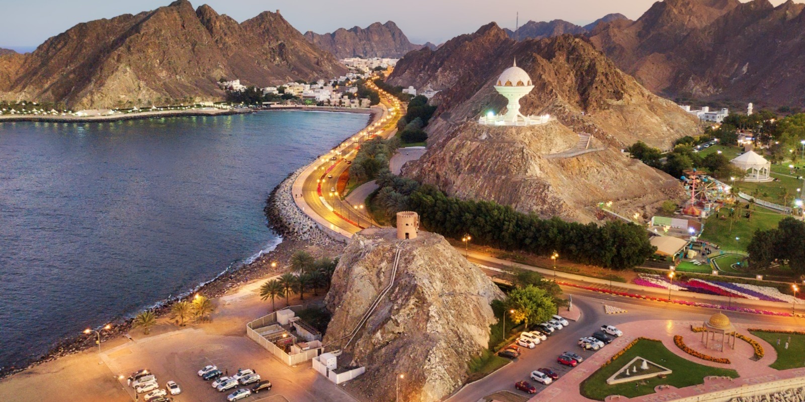
The stunning city of Muscat offers a captivating blend of old and new that stretches along the Gulf of Oman coastline. The city’s layout tells a fascinating story of how ancient traditions blend seamlessly with modern development.
Key Districts and Their Locations
Muscat spreads across several unique districts that give the city its distinctive character. As-Sīb, the city’s largest district, houses more than 478,000 residents and serves as the western gateway. The vibrant Bawshar district lies further east and buzzes with commercial activity. You’ll find the historic Muttrah district next, known for its beautiful corniche that leads to Old Muscat – the heart of the city’s heritage.
The main districts showcase different aspects of city life:
- Bawshar: A central hub filled with modern amenities
- Muttrah: A charming waterfront area with traditional souks
- Qurayyāt: A beautiful coastal stretch perfect for beach lovers
- Al-‘Āmrāt: A thriving residential neighborhood with reliable infrastructure
Major Landmarks as Navigation Points
Muscat’s landmarks serve as excellent reference points for visitors and locals alike. The magnificent Sultan Qaboos Grand Mosque stands proudly on its 416,000 square meter complex and acts as a central marker. The beautiful Mutrah Corniche stretches 3 kilometers along the waterfront and helps people find their way along the coast.
Natural Boundaries and Features
The city’s geography creates a remarkable urban landscape shaped by three distinct physiographic zones.
The majestic Hajar Mountains create a spectacular backdrop as they run parallel to the gulf coast. These mountains reach impressive heights of up to 9,777 feet at Mount Shams. The sparkling Gulf of Oman stretches along the northern edge, creating a beautiful 175-kilometer coastline from As-Sib to Ras al-Hadd. Natural harbors dot this coastline at Muscat and Muttrah.
The city covers an enormous area of 4,430km² with more than 100km of coastline. This expansive layout creates distinct neighborhoods separated by natural features. Understanding these geographical markers helps everyone navigate the city effectively.
Essential Navigation Tools and Resources
These tools and resources will make your trip through Muscat smooth and enjoyable. After testing many navigation options, here are the best ways to get around Oman’s captivating capital.
Digital Maps and Navigation Apps
Waze stands out as the most reliable navigation app and provides more accurate directions than Google Maps. It works exceptionally well when you navigate through newer developments and complex roundabouts. Avenza Maps is perfect to use offline. You can:
- Download professional maps for offline use
- Track your location without internet connectivity
- Add personal landmarks and measure distances
- Record your routes and share them with others
Physical Maps and Tourist Guides
Digital tools are convenient, but a physical map serves as a vital backup. Our interactive tourist map of Muscat is ready to print and includes:
- Major attractions and landmarks
- Restaurant locations
- Transportation hubs
- Shopping districts
This physical map becomes a lifesaver when phone batteries run low or in areas with poor reception.
Local Navigation Apps and Services
Muscat’s transportation scene has grown substantially, and several apps are now available that make getting around easier. The Mwasalat bus app tops our list to use public transportation. Here’s what makes it a must-have:
| Feature | Benefit |
|---|---|
| Real-time Updates | More accurate than Google Maps for bus timing |
| Interactive Map | Easy visualization of routes and stops |
| Journey Planner | Quickest way to plan trips with multiple options |
| Digital Payment | Option to add credit card for contactless payment |
OTaxi and Careem provide reliable ride-hailing services throughout Muscat. These apps are great to use in areas like Muttrah Souq or the coastal districts where parking can be difficult.
Note that downloading these apps before your trip and setting up payment information is important. Multiple navigation options are a vital part of your toolkit since each serves a unique purpose in different situations.
Public Transportation Navigation Guide
Public transportation in Muscat has become substantially better over the last several years. We want to share what we know about getting around the city. After learning every part of this beautiful city, we know the quickest ways to use its public transport network.
Bus Routes and Stations
Mwasalat, the state-owned bus company, runs the most dependable public transport in Muscat. Their modern, air-conditioned busses run on 12 city routes with dedicated airport services. The fares are simple:
| Zone Coverage | Cost (Baisa) |
|---|---|
| Single Zone | 300 |
| Two Zones | 400 |
| Three Zones | 600 |
| Airport Route | 1 OMR |
These routes are the ones we use most often:
- Route A1: Connects Ruwi Bus Station to Muscat International Airport (24/7 service)
- Route 4: Links Ruwi to Al Alam Palace, perfect for tourist attractions
- Route 8: Serves Burj Sahwa to Al Khuwair, passing major landmarks
Taxi Services and Ride-Hailing
We’ve tried many taxi options in Muscat. Ride-hailing apps are the best way to get around. OTaxi and Oman Taxi give reliable service with clear pricing. Here’s what we’ve learned:
- Hotels often have exclusive agreements with blue taxis
- Orange taxis typically offer lower fares (around 60% less)
- Airport pickups require using designated taxi services
- You should walk a short distance from hotels to use ride-hailing apps
Water Transportation Options
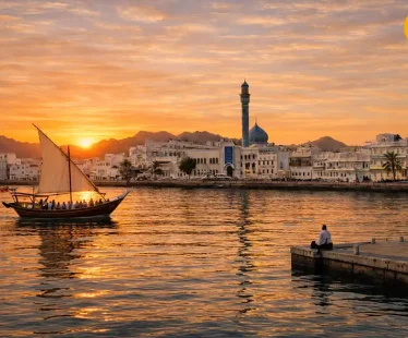
Water transportation in Muscat focuses on tourism rather than daily commuting. Traditional dhow boats run along the corniche area and offer scenic routes instead of practical transportation. Land-based options work better for daily travel needs.
Pro Tip: Download the Mwasalat mobile app before your visit. The app shows live bus locations and helps plan your trips through Muscat’s extensive transport network.
Navigating Major Tourist Districts
Now that we know our way around Muscat’s transportation system, let us show you the city’s most captivating districts. We’ve explored every corner of this amazing capital and want to share our insider tips to help you find your way around these unique areas.
Old Muscat and Muttrah Area
A maze of winding streets and ancient architecture reveals the historic heart of Muscat. The Muttrah Corniche makes a perfect starting point and stretches three kilometers along the waterfront. You can easily reach these key landmarks from here:
| Location | Navigation Tip | Best Time to Visit |
|---|---|---|
| Muttrah Souq | Follow the corniche west | Late afternoon |
| Al Alam Palace | Head east past the port | Early morning |
| Muttrah Fort | Look for hillside steps | Sunset |
Modern Commercial Districts
Qurum pulses with the city’s modern energy. This area amazes us as it grows into a vibrant hub for shopping and entertainment. The district looks better each day with its new urban planning and lighting that makes visitors feel more welcome.
These landmarks help you find your way in the commercial district:
- The Royal Opera House (primary landmark)
- Qurum Natural Park (green space reference point)
- Qurum Beach Road (coastal orientation)
Coastal Areas and Beaches
The city’s spectacular coastline runs along a narrow strip between the mountains and sea, and it never fails to amaze us. Each beach we’ve visited has its own special character. Qurum Beach runs for 2.5 miles (4km) next to the city center, with palm trees lining its shore that help you get your bearings.
The distinctive Hajar Mountains serve as our constant guide along the coastal areas. These mountains have stood guard over the city for centuries. Traditional dhow boats and modern marinas on the ocean side help you spot specific locations.
The corniche works best as your guide to explore the beaches. This waterfront promenade links major coastal attractions with clear views of both mountains and sea. A walk along the corniche helps you understand Muscat’s coastal layout best, especially when the sun sits low over the Hajar Mountains during golden hour.
Pro Navigation Tip: Fish markets make excellent reference points along the coast. The Muttrah Fish Market stands out as a great landmark in the older part of the city. Visit early in the morning to experience the market at its busiest.
Tips for Hassle-Free Navigation
Our travels around Muscat taught us that getting around isn’t just about knowing your way—it’s about understanding the local culture and being ready for whatever comes your way. These are our field-tested tips to help you explore this beautiful city without any hassle.
Local Customs and Street Etiquette
Being mindful of local customs has improved our experience in Muscat. We dress right for the occasion—women wear loose clothes that cover shoulders and knees, while men skip shorts in traditional areas. This cultural awareness makes it easier to connect with locals and get directions.
These etiquette tips have worked great for us:
- Greet locals with “Salaam Aleikum” to ask for directions
- Keep voices low and stay calm in public spaces
- Don’t take photos without asking, especially of people
- Use your right hand for gestures and interactions
- Dress modestly, especially in rural areas
Common Navigation Challenges
The Muscat Oman map comes with its own set of challenges. GPS systems aren’t as reliable as you’d think. Google Maps works differently here—you can input destinations, but voice navigation doesn’t work in Oman.
These tips will help you navigate better:
- Download offline maps before leaving your hotel
- Look out for exit signs on highways
- Navigate using landmarks instead of street names
- Use the Hajar Mountains as your reference point
- Follow brown tourist signs in Arabic and English
Highway exits can be 30 minutes apart. We always check our routes beforehand and keep track of Oman’s major landmarks to avoid missing important turns.
Emergency Navigation Resources
Safety comes first, so here’s our detailed list of emergency contacts that have helped us:
| Emergency Service | Contact Number | Response Time |
|---|---|---|
| Police | 9999 | Immediate |
| Ambulance | 24603988 | 10-15 min |
| Fire Department | 999 | Immediate |
| Water Emergency | 153 | Variable |
Save these numbers in your phone before you start exploring. Muscat’s police force works quickly and helps a lot with navigation emergencies.
Pro Safety Tip: A physical copy of your hotel’s address in English and Arabic can be a lifesaver. This helps when talking to taxi drivers or asking locals who might not speak English.
Weather can affect your plans, especially during rare rain events. We check forecasts and stay away from mountain routes or wadis if rain might be coming. Local authorities have put up water level indicators near wadi crossings—we always keep an eye on these.
Most tour operators in Muscat provide private driver services. This option takes away the stress of navigating tricky areas of the city by yourself.
Conclusion
Getting around Muscat might feel overwhelming at first. Our detailed guide shows how easy and rewarding it becomes with good planning. The city combines historic districts, modern areas, and natural landmarks into a fascinating layout that rewards careful attention.
Success in getting around Muscat depends on three things: knowing the city’s unique layout, having good navigation tools, and following local customs. You’ll find joy in exploring everything from the busy Muttrah Souq to peaceful coastal spots with our suggested digital apps, physical maps, and cultural tips.
Being flexible helps you move through Muscat’s different districts smoothly. You can switch between ride-hailing apps, public busses, or traditional taxis to adjust your plans based on weather, time, or unexpected changes.
The best part about moving through Muscat is the chance to connect with this amazing city. Some of our best experiences came from taking wrong turns that led to hidden spots or friendly chats with locals who were happy to point the way.


